Local Development and Adaptation to Climate Change in Chad

Local Development and Adaptation to Climate Change in Chad

Integrated Water Resource Management Plan by Antea Group

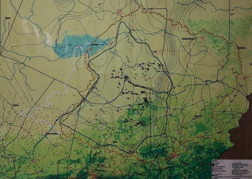
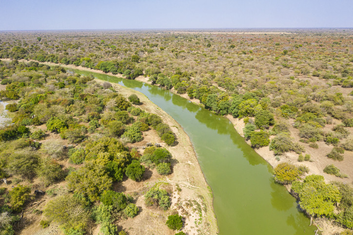
The Ouadi Rime Ouadi Achim (OROA) wildlife reserve is not only the largest protected area in Chad, but also one of the largest in Africa, covering 80,000 km2. This region is known for grazing, wood gathering, and agricultural activities, and is globally significant for its diverse birdlife and mammals. However, the area faces various challenges such as natural resource management, climate shocks, and access to poor-quality water and sanitation.

The challenge

In this context, funded by the World Bank, the Chad Ministry of the Environment, Fisheries, and Sustainable Development has launched the Local Development and Adaptation to Climate Change (ALBIA) Project. This project aims to improve the livelihoods of communities, conserve biodiversity, and mitigate the impact of climate change around the OROA reserve, through four components:

  • Implementing sustainable, climate-sensitive land restoration practices.
  • Enhancing the management of protected areas for conservation and sustainable use.
  • Providing climate-sensitive agricultural services for local populations.
  • Improving access to clean drinking water services.
Integrated Water Resource Management Plan by Antea Group

Antea Group in Action

In partnership with the Chadian firm Genial, Antea Group France is involved in the “Planning and monitoring of water resources” sub-component, with the ultimate aim of publishing a scientific paper on the study area and the drafting of an Integrated Water Resource Management Plan (IWRMP). This plan will guide planning options for the use of water resources and propose an investment plan for developments to increase the availability of resources, all with an integrated approach taking into account all sectors of water use and their respective challenges.

The study comprises eight activities:

  • Bibliographical study,
  • Installation of meteorological stations and training,
  • Remote sensing study,
  • Fieldwork to inventory water points and define the contextual framework,
  • Geophysical studies,
  • Geological reconnaissance drilling,
  • Conceptual hydrogeological model and assessment of the water balance,
  • Water resources management plan for the region.